North Atlantic right whale density surface model for the US Atlantic evaluated with passive acoustic monitoring
By Jason J. Roberts, Tina M. Yack, Ei Fujioka, Patrick N. Halpin, Mark F. Baumgartner, Oliver Boisseau, Samuel Chavez-Rosales, Timothy V. N. Cole, Mark P. Cotter, Genevieve E. Davis, Robert A. DiGiovanni Jr., Laura C. Ganley, Lance P. Garrison, Caroline P. Good, Timothy A. Gowan, Katharine A. Jackson, Robert D. Kenney, Christin B. Khan, Amy R. Knowlton, Scott D. Kraus, Gwen G. Lockhart, Kate S. Lomac-MacNair, Charles A. Mayo, Brigid E. McKenna, William A. McLellan, Douglas P. Nowacek, Orfhlaith O’Brien, D. Ann Pabst, Debra L. Palka, Eric M. Patterson, Daniel E. Pendleton, Ester Quintana-Rizzo, Nicholas R. Record, Jessica V. Redfern, Meghan E. Rickard, Melanie White, Amy D. Whitt, and Ann M. Zoidis
Originally published in Marine Ecology Progress Series in March 2024

Abstract
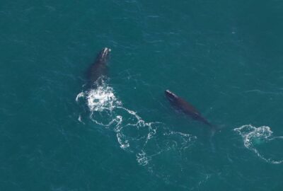
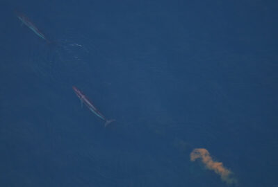
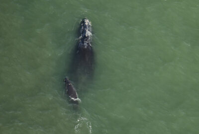
The Critically Endangered North Atlantic right whale Eubalaena glacialis entered a population decline around 2011. To save this species without closing the ocean to human activities requires detailed information about its intra-annual density patterns that can be used to assess and mitigate human-caused risks. Using 2.9 million km of visual line-transect survey effort from the US Atlantic and Canadian Maritimes conducted in 2003-2020 by 11 institutions, we modeled the absolute density (ind. km-2) of the species using spatial, temporal, and environmental covariates at a monthly time step. We accounted for detectability differences between survey platforms, teams, and conditions, and corrected all data for perception and availability biases, accounting for platform differences, whale dive behavior, group composition, and group size. We produced maps of predicted density and evaluated our results using independently collected passive acoustic monitoring (PAM) data. Densities correlated positively (r = 0.46, ρ = 0.58, τ = 0.46) with acoustic detection rates obtained at 492 stationary PAM recorders deployed across the study area (mean recorder duration = 138 d). This is the first study to quantify the concurrence of visual and acoustic observations of the species in US waters. We summarized predictions into mean monthly density and uncertainty maps for the 2003-2009 and 2010-2020 eras, based on the significant changes in the species’ spatial distribution that began around 2010. The results quantify the striking distribution shifts and provide effort- and bias-corrected density surfaces to inform risk assessments, estimations of take, and marine spatial planning.
Full Text
Affiliated Authors


Related Stories
Research That Drives Action
Through pioneering conservation research and strategic partnerships, our team of 40 scientists at the Anderson Cabot Center for Ocean Life works to combat the unprecedented impacts on the ocean from climate change and other human activities.
