Tickets for Saturday, 7/18, are sold out online and in person. Tickets for 7/19 are still available!
Sea Turtle Tracker
Here you’ll find an interactive map of sea turtles that have been tagged by the New England Aquarium. Follow their journey below!
Click on an individual turtle listed in the right column of the map to learn more about species and tracking duration.
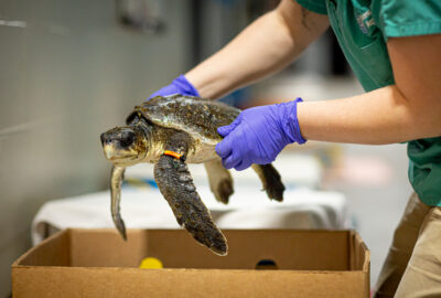
Turtles categorized as “Rehab” were tagged at our Animal Care Center in Quincy (under permit USFW#ES69328D) and turtles categorized as “Nesting” were tagged on nesting beaches in Puerto Rico in collaboration with Puerto Rico Departamento de Recursos Naturales y Ambientales, Amigos de las Tortugas Marinas, Chelonia, Proyecto de Conservación de Tortugas Marinas – Vida Marina, and the St. Croix Sea Turtle Project (under DRNA Permits #2023-EPE-016, #2024-EPE-017, #2024-EPE-008, #2024-EPE012).
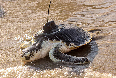
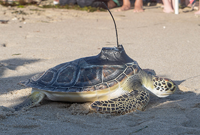
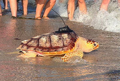
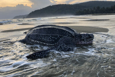
Meet the Turtles
These are the species of sea turtles featured in the map above.
Frequently Asked Questions
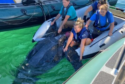
We rehabilitate hundreds of injured turtles each year, and our Anderson Cabot Center for Ocean Life scientists track a subset of them to collect data on post-release survivorship and behavior, and to improve sea turtle welfare, conservation, and protection. We also use tags to understand leatherback turtle nesting, foraging and migratory behaviors, and habitat-use, as well as post-release outcomes of disentangled turtles. Learn more about our work to protect sea turtles.
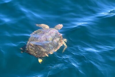
We use satellite tags and acoustic transmitters to study four of the seven species worldwide, including Kemp’s ridley, leatherback, loggerhead, and green sea turtles.
Any time you attach something to a wild animal, you have the potential to impact its natural behavior. When we attach tags to sea turtles, we consider the impact from both a welfare and scientific perspective. In other words, we want to prioritize the turtle’s health and safety, while also ensuring we don’t affect data on their natural behaviors. To reduce impact, we minimize the footprint of the tag, use a hydrodynamic design, and paint our tags with anti-fouling paint. The combined weight of the tag and attachment materials are 5% or less of the turtle’s body mass, and typically less than 1%. We expect most of the turtles to shed their satellite tags within about one year.
Location data from satellite tags always contain error and locations you see on the maps are not exact. If you see a position on land, rest assured that the turtle is still in the water! Tag transmissions are intermittent and unpredictable, relying on turtles to be at the surface with the tag antenna “in view” of overhead satellites. These factors make it very difficult to locate these turtles at sea. As researchers, we find this a little frustrating since we sometimes need to relocate tagged turtles! On the other hand, tag data is beneficial since it identifies “high-use” areas that can be relayed to fishermen or others in real time and help them avoid unwanted interactions with protected species.
The most common reasons for a lack of transmissions are tag damage (especially to the antenna), attachment failure, biofouling on the tag’s salt water switches, and battery depletion. In some cases, we can infer mortality of a turtle from its tag data. Depending on battery size and programming, satellite tags usually last anywhere from 6 months to just over a year.
Science in Action
Learn more about how our Anderson Cabot Center for Ocean Life scientists use information gathered from tags to protect these endangered species.
Make a Difference for Sea Turtles
Your support makes a difference for threatened and endangered marine life everywhere by helping provide the Aquarium with the resources to conduct research through our Anderson Cabot Center for Ocean Life, advocate, and rehabilitate.
